Clear maps for every project boundary and land unit.
Connect every field entry, soil sample, and piece of equipment to a verified location and a clear site boundary.
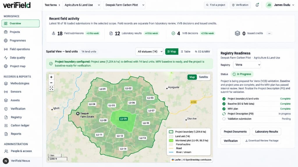
See your project boundaries alongside reporting progress.
Inspect individual land units inside your project perimeter while tracking which documents and field records are complete for each site.
 Illustrative interface
Project boundaries and numbered land units
Map your overall project area and divide agricultural or forestry sites into individually tracked land units (such as LU-01 through LU-14) with automatic area calculations.
Automatic location checks on field entries
Verify that incoming field observations, soil samples, and equipment installations fall inside your registered project boundaries.
Prevent overlapping plots and duplicate logs
Spot overlapping parcel boundaries or duplicate GPS entries early so two records are never counted for the same piece of land.
Satellite map layers and site context
View your mapped plots alongside satellite imagery and site boundaries to support land-use and reforestation monitoring.
Bring your next climate project into focus.
Request an organization workspace for your project team, or speak with us about your field monitoring and reporting needs.