One connected workspace for your climate projects.
VeriField Nexus brings project setup, field data collection, site maps, internal quality checks, and report preparation together in one place.
Track field submissions, land units, and review progress over time.
Instead of piecing together updates from different spreadsheets and folders, project managers can see incoming field entries, mapped land units, and review status in one clear dashboard.
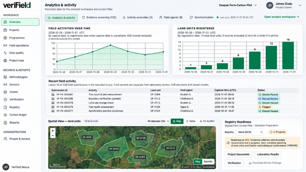 Illustrative interface
Five core capabilities working together.
Built so project managers, field teams, internal reviewers, and independent auditors can work from the same organized project record.
Separate, secure workspaces for each organization
Every organization works inside its own dedicated environment with clear role permissions for project managers, field coordinators, field officers, and visiting auditors.
Field data collection that works offline
Capture activity logs, GPS locations, site photographs, and laboratory sample records in the field—even when internet connectivity is intermittent.
Clear sector and methodology checklists
Match your project to the right sector workflow so field teams collect the exact records required, while keeping full calculations separate from general tracking.
Project boundary maps and land-unit tracking
Map your project sites and individual land parcels so every field entry is tied to a verified location and checked against boundary overlaps.
Internal quality checks and report preparation
Review incoming field records, resolve missing details early, and assemble organized report packages for independent third-party verifiers.
Bring your next climate project into focus.
Request an organization workspace for your project team, or speak with us about your field monitoring and reporting needs.